GIS Day 2026: The Young Africans Leading Conservation, Map by Map
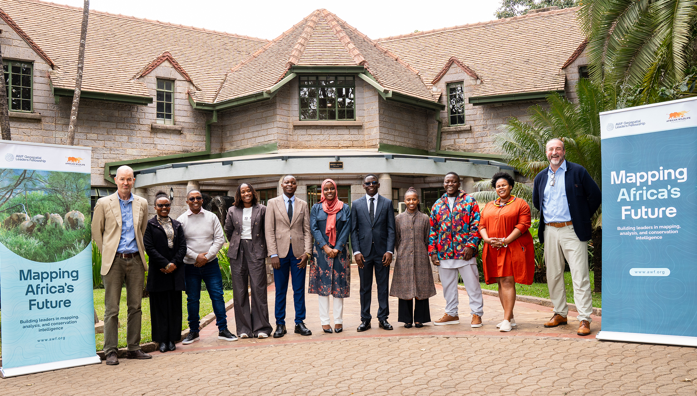
AWF Geospatial Leaders Fellowship Cohort One Workshop in Nairobi, Kenya. © AWF
As Africa navigates growing pressures on its natural resources, land and wildlife, Geographic Information Systems (GIS) are becoming increasingly important in understanding conservation challenges, informing decisions and shaping sustainable solutions. Through the African Wildlife Foundation’s (AWF) Geospatial Leaders Fellowship, emerging African professionals are gaining the technical expertise and leadership skills to harness geospatial technology in addressing these challenges and advancing conservation across the continent
Lissong Diop and Julius Ivan did not set out to change conservation. One studied Geological Engineering, the other Environmental Sciences, and both began as young professionals building careers like so many others. Today, through geospatial technology, they are changing how Africa protects its wildlife and its wetlands. Lissong is showing park teams in Senegal which areas are most susceptible to fire over the next 15 days and which species lie in its path. Julius is showing Uganda's environmental institutions which wetlands are intact, degraded or seasonal.
Both are fellows of the African Wildlife Foundation's Geospatial Leaders Fellowship, and their stories show that the future of conservation in Africa will be shaped by people just like them, given the right skills and the confidence to lead.
The theme of GIS Day 2026 is "GIS: Powering Purpose and Innovation". At AWF, it is less a slogan than a way of working.
Across Africa, conservation decisions depend on understanding how landscapes are changing, where environmental pressures are emerging, and what it all means for people and wildlife. Geographic Information Systems (GIS) give us that view. At AWF, geospatial technology is part of how we think, plan and act, turning satellite imagery and data into smarter, faster and fairer conservation decisions.
But data alone changes nothing. Turning it into action takes professionals who can communicate their findings, collaborate across disciplines and influence decisions. That is why AWF invests in people as much as in technology. The Geospatial Leaders Fellowship is a 10-month programme combining technical training, leadership development, mentorship and practical capstone projects, equipping young African professionals to apply geospatial technology to real conservation challenges.
Meet two members of Cohort One.
Lissong Diop: Connecting Geospatial Research with Wildfire Prevention in Senegal
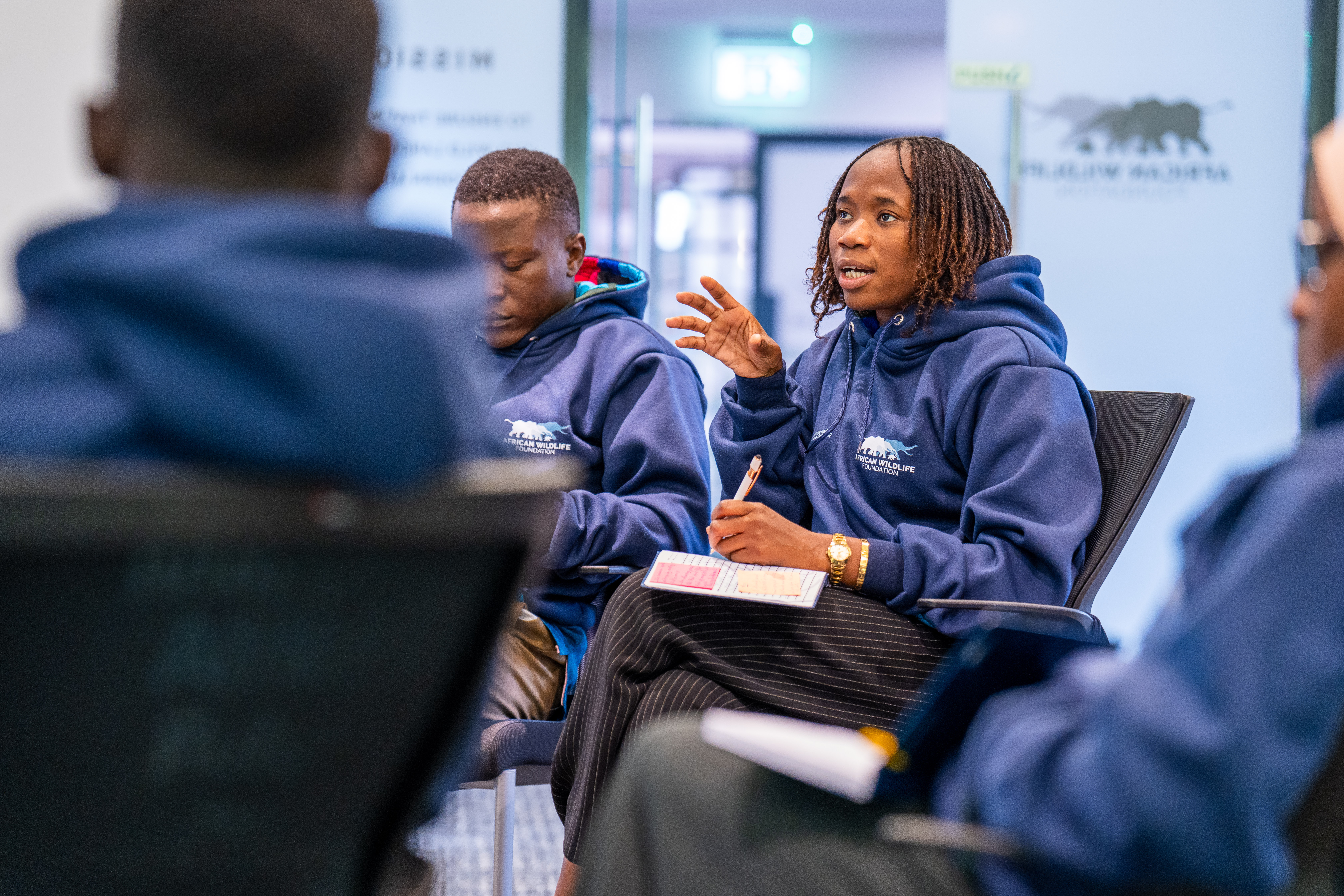
Lissong Diop participating in an AWF Geospatial Leaders Fellowship workshop in Nairobi, Kenya. © AWF
Lissong Diop studied Geological Engineering at Cheikh Anta Diop University of Dakar and started out in geotechnical engineering. Then came an opportunity to contribute to research on coastal erosion and wetlands and with it an introduction to GIS and remote sensing. Today she is a geospatial researcher at Senegal's Centre de Suivi Écologique (CSE) and is pursuing a PhD in Remote Sensing.
Her technical expertise was already strong. What she wanted was the confidence to carry it into the rooms where decisions are made.
"Through the AWF Geospatial Leaders Fellowship, I have strengthened my ability to communicate geospatial information in ways that are accessible and useful to different audiences. I have also gained a better understanding of how to connect technical findings with the needs of institutions and communities to inform natural resource management and conservation decisions," says Lissong.
She put that learning to work in her capstone project, Where Fire Meets Wildlife. Drawing on CSE's wildfire records from 2010 to 2025 and environmental data derived from satellite imagery, she developed a model that identifies areas more susceptible to fire over a 15-day forecasting period. She then added biodiversity information from Map of Life and the International Union for Conservation of Nature (IUCN) to show which species may be threatened where susceptibility is highest.
Presented through an interactive StoryMap focusing on Niokolo Koba national park, and two dashboards, the project is intended to help environmental services, patrol teams and protected area managers identify priority areas for prevention and direct limited resources more effectively.
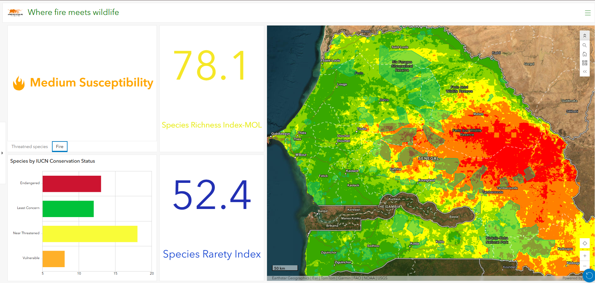
A geospatial dashboard integrating wildfire susceptibility mapping and biodiversity indicators to identify areas where wildlife is most vulnerable to fire and inform proactive fire management and conservation priorities in Senegal. © AWF
Lissong also adds, "My colleagues at CSE have expressed interest in exploring how the tool could complement the organisation's existing wildfire monitoring system, bringing a more forward-looking approach to fire prevention. This is an important step towards translating my research into a practical tool that could support the organisation's work," says Lissong.
Her growing influence has taken her further still: she has been selected as Senegal's representative among the 100 Global Youth Water Envoys ahead of the UN Water Conference in Abu Dhabi in December 2026.
"I would encourage other young professionals to apply for the fellowship because it offers an opportunity to grow beyond your technical expertise, develop leadership skills, learn from others and build connections with professionals across Africa. It helps you see how your knowledge can contribute to conservation challenges in your country," she says.
Julius Ivan: Putting Uganda's Wetlands on the Map
Julius Ivan, AWF Geospatial Leaders Fellow, Cohort 1. © AWF
For Julius Ivan, the spark came at Makerere University, where he specialised in GIS and remote sensing during his undergraduate studies in Environmental Sciences. He was drawn to the way spatial data reveals patterns and went on to build experience in urban mapping, environmental monitoring and natural resource management. Today he is a Senior Environment Officer at Uganda's National Environment Management Authority (NEMA).
His capstone project tackled wetland degradation in southwestern Uganda. Using satellite imagery and geospatial analysis, Julius built an interactive dashboard that maps wetland areas and shows their condition, distinguishing between intact, degraded and seasonal wetlands. Users can explore specific locations and see the extent and distribution of degradation for themselves.
He also developed a complementary tool for environmental officers during field inspections. Information collected on mobile devices is consolidated into a central system, so officers can track inspected areas, identify compliance concerns and see where follow-up action may be needed.
"Together, these tools help environmental institutions identify areas requiring attention and strengthen wetland monitoring, planning and enforcement. They also demonstrate how geospatial technology can bring different forms of environmental information together to support more coordinated decision-making," Julius notes.
For him, the capstone was a chance to move beyond technical exercises and respond to an actual conservation challenge. And the fellowship taught him that the best map is only the beginning.
"One of my key takeaways from the fellowship is that conservation requires more than technical expertise. It also calls for collaboration, effective communication, and meaningful community engagement to develop solutions that address environmental challenges," he states.
Looking ahead, Julius hopes to use his new skills and connections to strengthen environmental monitoring in Uganda and sees real opportunity in government agencies and conservation institutions sharing geospatial information.
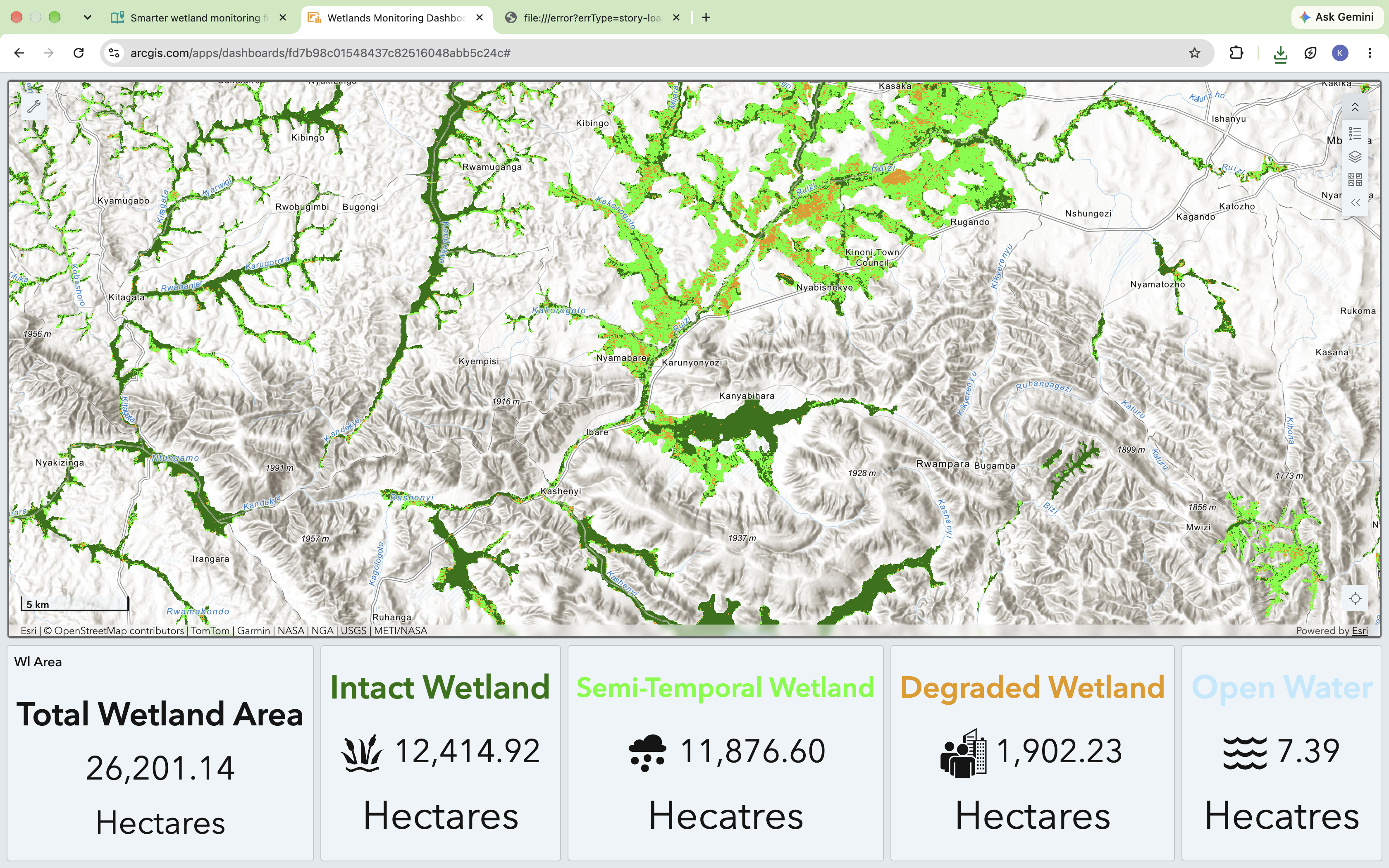
A dynamic ArcGIS Dashboard for monitoring wetland changes in southwestern Uganda. © AWF
Leaders Who Connect Conservation and Development
Lissong and Julius work in different countries, on different ecosystems, with different tools. Yet their stories share one thread: each has turned data into decisions that serve both nature and the people who depend on it. That is where conservation and development meet. A fire forecast that protects Niokolo Koba also protects livelihoods. A wetland map that guides enforcement also safeguards the farmers who rely on those wetlands.
This is why building African geospatial leaders matters, the future of conservation will depend not only on the information available to decision-makers but on the people equipped to make sense of it and use it. A strong pool of African geospatial professionals ensures that local expertise informs conservation priorities, natural resource management and policy. Investing in that expertise is an investment in Africa's ability to shape its own conservation future.